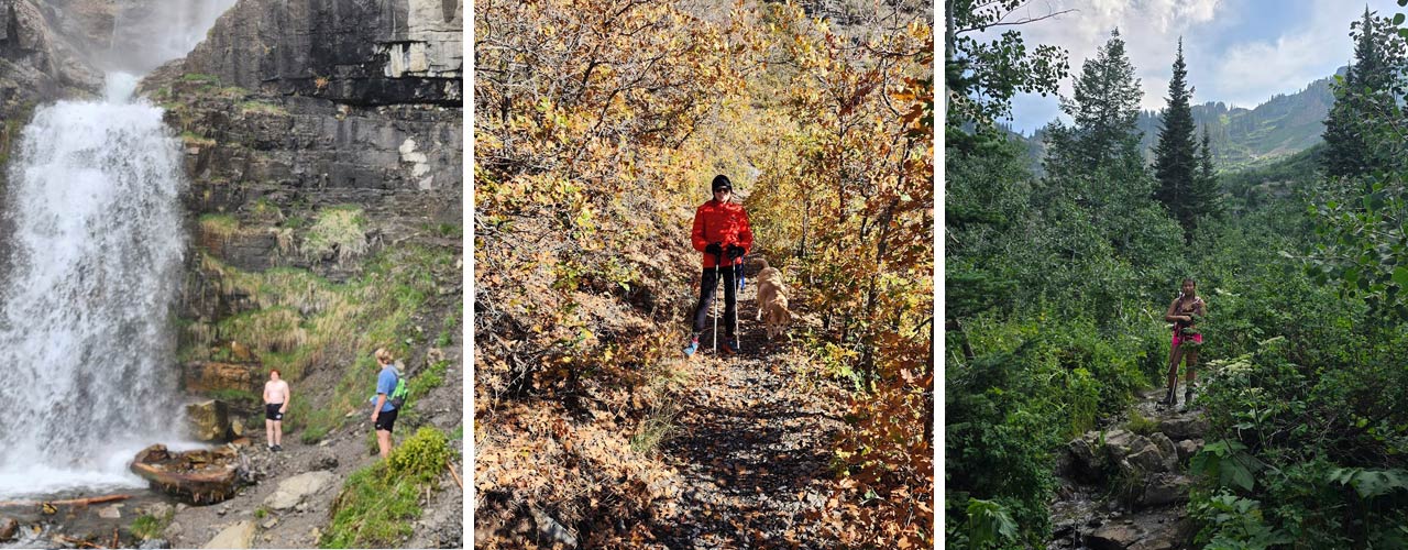
Hiking along the wasatch front

The Wasatch Front, a majestic mountain range stretching across northern Utah, offers some of the state’s most accessible and scenic hiking trails. With options for all skill levels, from family-friendly walks to strenuous summits, the Wasatch Front is perfect for anyone exploring Utah’s natural beauty near the Salt Lake City metropolitan area. Here are some of the best hiking destinations along the Wasatch Front.
Ensign Peak (Salt Lake City)
Located just above Salt Lake City, Ensign Peak is a short, easy hike that rewards hikers with a panoramic view of the city and the Great Salt Lake. This trail is perfect for beginners or those looking for a quick adventure near downtown.
- Distance: 1 mile round trip
- Elevation Gain: 374 feet
- Map & Guide: Ensign Peak Trail
Mount Olympus (Salt Lake City)
For a more challenging climb, Mount Olympus is one of the most iconic peaks along the Wasatch Front. The trail is steep, rocky, and strenuous, but the view from the top over Salt Lake Valley is worth the effort.
- Distance: 7.5 miles round trip
- Elevation Gain: 4,143 feet
- Map & Guide: Mount Olympus Trail
Donut Falls (Big Cottonwood Canyon)
Donut Falls is a family-friendly hike in Big Cottonwood Canyon, just 30 minutes from Salt Lake City. The relatively easy trail leads to a unique waterfall that cascades through a hole in the rock, resembling a “donut.”
- Distance: 3 miles round trip
- Elevation Gain: 452 feet
- Map & Guide: Donut Falls Trail
Lake Blanche (Big Cottonwood Canyon)
Lake Blanche is one of the most popular trails along the Wasatch Front for those seeking a moderate to challenging hike. The trail climbs steadily to a stunning alpine lake surrounded by rugged peaks, including Sundial Peak.
- Distance: 6.8 miles round trip
- Elevation Gain: 2,700 feet
- Map & Guide: Lake Blanche Trail
Red Pine Lake (Little Cottonwood Canyon)
Red Pine Lake, nestled in Little Cottonwood Canyon, is a favorite among hikers seeking a scenic alpine destination. The trail passes through dense forests and offers beautiful views of the surrounding canyon before reaching the serene lake.
- Distance: 7 miles round trip
- Elevation Gain: 2,000 feet
- Map & Guide: Red Pine Lake and Gloria Falls Trail
Hiking the Bonneville Shoreline Trail
The Bonneville Shoreline Trail is a long, multi-use trail that runs along the Wasatch foothills. It provides hikers with a less strenuous option for enjoying the outdoors while offering excellent views of the Salt Lake Valley and the surrounding mountains. The trail can be accessed from numerous points along the Wasatch Front.
- Distance: Varies
- Terrain: Foothills, valleys, and city views
- Map & Guide: Bonneville Shoreline Trail
Grandeur Peak (Mill Creek Canyon)
Grandeur Peak offers a great mix of challenge and scenery. The trail takes hikers through wooded areas and rocky ridges, ending with a fantastic view over the Salt Lake Valley and into Parley’s Canyon.
- Distance: 6.2 miles round trip
- Elevation Gain: 2,900 feet
- Map & Guide: Grandeur Peak Trail
Adam’s Canyon (Layton)
Adams Canyon, located near Layton, is a beautiful hike that takes you through wooded areas and a creek to a stunning 40-foot waterfall. It’s a moderate hike with a steady incline, making it great for intermediate hikers.
- Distance: 3.8 miles round trip
- Elevation Gain: 1,312 feet
- Map & Guide: Adam’s Canyon Trail
Antelope Island State Park (Davis County)
Located in the Great Salt Lake, Antelope Island State Park offers scenic hikes with opportunities to see wildlife like bison, antelope, and various bird species. The trails here range from easy to moderate, with the Frary Peak Trail being the most challenging and rewarding for summit-seekers.
- Distance: Varies (Frary Peak Trail: 7 miles round trip)
- Terrain: Desert landscape, lake views, wildlife
- Map & Guide: Antelope Island State Park
Hidden Falls (Big Cottonwood Canyon)
Hidden Falls is a short, easy hike in Big Cottonwood Canyon. It’s perfect for families or those looking for a quick nature escape. The waterfall is smaller and picturesque.
- Distance: 0.3 miles round trip
- Elevation Gain: Minimal
- Map & Guide: Hidden Falls Trail
Additional resources for Wasatch Front hiking:
- Wasatch Front Hiking AllTrails: Interactive maps and detailed trail information for hikes throughout the Wasatch Front.
- Visit Utah Hiking Guide: A comprehensive guide to hiking trails across the state, including the Wasatch Front.
The Wasatch Front offers a variety of hiking experiences, from leisurely strolls through picturesque canyons to challenging summit climbs. Whether you’re a seasoned hiker or just starting, these trails provide something for everyone. Be sure to check trail conditions and weather before you go, and enjoy the stunning natural beauty of the Wasatch Mountains!